|
INTERACTIVE MAPS THAT HELP YOU RETRIEVE INFORMATION | |
|---|---|
|
Geographic Location |
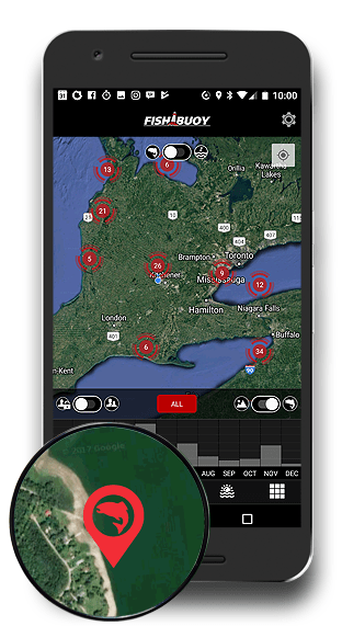
Each time you take a photo with FISHBUOY Mobile, you add to your portfolio of fish catches. With a few simple clicks you can pull up your fish catch locations, date and time, water conditions, weather conditions, species of fish, and much more! |
|
Timing |
How many times have you been out with your fishing friends, anxiously planning your next trip together? Inevitably, you begin to refer to your past fishing trips and 9 times out of 10, you argue about the location, conditions and of course, size and quantity of fish. As a map-centric application, FISHBUOY Mobile helps you to quickly access those historical fish catches and provides measurable information - no more need for guessing. |
|
Trend Building |
Your catches are plotted on a map helping you to conduct indepth analysis of your fishing success - using spatial and temporal techniques. A big advantage with FISHBUOY Mobile is that you can combine public photos posted by others, with your photos, to get a statistically sense of where the best locations are to fish. |
|
Getting Back to Your Spot |
While on the water or hiking across lands, FISHBUOY Mobile offers real-time tracking of your current location relative to your fishing spots. Like a navigation system, FISHBUOY Mobile will help you get to your fishing hole. |

