
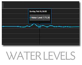
Learn how levels affect fishing.
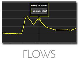
Know what flow rate is best.
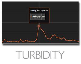
Fish when water clarity is right.
FISHBUOY helps fishermen by providing water data for major reservoirs, lakes, rivers and streams across North America. FISHBUOY integrates data from the USGS National Water Information System and the Water Office of Canada to provide real-time and historical water data that you can use to make smarter decisions. Get FISHBUOY today and start learning how water conditions impact your fishing success.
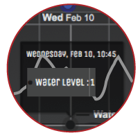
Water levels play an important role when determining the best places to fish. Whether fishing man-made reservoirs or natural rivers, both fluctuate throughout the year based on precipitation amounts or operational works. Changes in water levels directly influence fish feeding behaviour and holding patterns. If you want to catch fish, you will need to begin developing your knowledgebase.
HIGHLIGHTS | WHY UNDERSTANDING WATER LEVELS WILL HELP YOU CATCH FISH |
|---|---|
"Ups" and "Downs" | There is no better time to fish when water is on the 'rise' or the 'decline'. During rise periods, migrating fish use the higher levels to move through shallow areas. It also provides a higher concentration of food sources that can trigger feeding. Anglers can take advantage of rise periods by focusing on more noticable current breaks for example behind rocks, in high/low velocity seams, etc. Declining water levels often put fish into a holding pattern, patiently waiting for the next rise in water level to move up river. Low water level periods help to concentrate fish in pools and deeper water riffle areas and can offer anglers amazing fishing opportunities. |
Changing Fishing Structure | During high reservior levels, fish may find more structure along the shorelines. As water recedes, those structures move above the waterline, forcing fish to find new structure. Use FISHBUOY photos to establish those locations. |
Water Clarity | In the absence of turbidity monitoring, water levels can offer hints to what the water clarity may look like. Pay attention to your fish photo data and begin to build your history, correlating water levels with fish catches. |
Safety on the Water | High water can create dangerous wading conditions, low water can create hazardous boating conditions. Pay attention! |
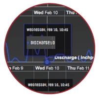
Why do fishermen care about water discharge? How can fishermen benefit from having this data? Water discharge or streamflow are terrific indicators of how fast or slow water is moving in a river, stream or reservoir. This helps fishermen determine whether a location is fishable to begin with. Understanding discharge can also help fishermen determine the right tactics for high or low discharge rates. Use FISHBUOY Photos to create a history of discharge rates vs. fish catches to determine your optimal flows.
HIGHLIGHTS | WHY UNDERSTANDING DISCHARGE WILL HELP YOU CATCH FISH |
|---|---|
Water Preference | Fish will favour their biological preferences to water flow. During high discharge, look for seams and slower moving pockets of water. |
Feeding Behaviour | High discharge rates impacts the amount of time your bait is in a fishes visual strike zone. Make it easier for fish to see your bait by using larger baits or higher vis colors. (See Great Lakes Spawn Tying Guidelines) |
Seasonal Trigger | Pay attention to signifcant increases in discharge rates around the time of spawning periods. High stream flows flush sweet water into large water bodies and can act as a trigger for pre-spawn migrations. |
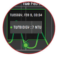
FISHBUOY TripPlanner provides real-time and historical water turbidity graphs for rivers and reservoirs across North America. In a single view, you will better understand which water is fishable - and which is blown. You will also have the ability to correlate historical weather events and how they impact water turbidty. This allows fishermen to predict what water conditions might look like in a few days based on the precipitation forecast.
HIGHLIGHTS | WHY UNDERSTANDING TURBIDITY WILL HELP YOU CATCH FISH |
|---|---|
Bait Selection | Determine the best bait colors and styles for the turbidity levels. |
Predict Precipitation Impacts | Refer to fish catch data and turbidity graphs and anticipate how precipitation with change water turbidity at your favourite fishing spots. |
Species Tolerance | Quick access to fish catch data and turbidity data provides you with deeper insight into which fish are more active during turbidity events. |
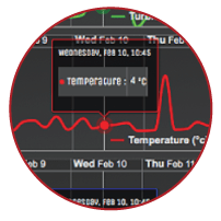
Water temperature is among the most important water parameters for fishermen, yet many of us don't take the time to measure conditions in the field. Fly fishermen use water temperature to gauge insect hatches. Great Lakes fishermen use deep water instruments like the FISHHAWK to determine the thermocline where fish are active. Salmon and Steelheaders use water temperature to estimate when fish will start running rivers. Bass fishermen will know when it is time to change to slow presentations or live bait. Along with other water parameters, FISHBUOY TripPlanner collects water temperatures every hour and stores it for your use. Using the FISHBUOY Mobile Timeline Filter, coupled with FISHBUOY TripPlanner, you will develop a more complete picture of the conditions you are planning for.
HIGHLIGHTS | WHY UNDERSTANDING TEMPERATURE WILL HELP YOU CATCH FISH |
|---|---|
Fish Migrations | Discover water temperatures that trigger pre-and-post spawn movement. Plan to fish then. |
Fish Activity | Determine the range of water temperatures that impact your target fish species. Search the map and determine patterns and trends. |
Fish Holding Patterns | Fish will naturally move to their preferential water temperatures. Start to build a range of water temperatures for your target species by capturing this information using FISHBUOY Mobile. |
Fish Presence | Be smart about how you plan your trips. Don't expect to find Brook Trout in warm water reservoirs. Pay attention to water temperature. |


